

Flock cameras in Tennessee
3,641 documented license plate readers across 210 Tennessee cities and towns. 3,169 are tagged as Flock Safety equipment (87%), and 95% have a recorded facing direction.
615 of them sit outside any town boundary, on county roads, interstate ramps and rural junctions between municipalities. That is why the state total is larger than the sum of the towns below.
Towns with their own page
Driving in Tennessee? Get a heads-up first.
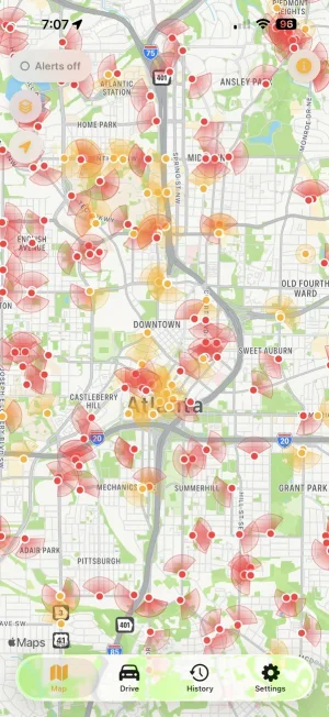
All 3,641 are already in the app. An alert as you approach each one, and a second if you enter its field of view.

 Scan with your iPhone
By brand
| Brand | Cameras | Share |
|---|---|---|
| Flock Safety | 3,169 | 87.0% |
| Motorola Solutions | 188 | 5.2% |
| Genetec | 74 | 2.0% |
| Axis Communications | 37 | 1.0% |
| Axon | 20 | 0.5% |
| Neology | 19 | 0.5% |
| SkyCop, Inc. | 15 | 0.4% |
| Skycop | 9 | 0.2% |
Most-recorded operators
| Operator | Cameras |
|---|---|
| JCPD | 43 |
| Lowe's | 39 |
| Flock Safety | 33 |
| The Home Depot | 18 |
| Bristol TN Police Department | 15 |
| Mt. Juliet | 8 |
| Union City Police Department | 8 |
| jcpd | 7 |
Operator is recorded by volunteers and is missing for most cameras, so these are documented floors rather than totals.
Other places in Tennessee
These have documented cameras but fewer than eight, not enough for a page of their own, so they are listed here instead.
Show 191 places
- Bartlett25
- Arlington24
- Millington24
- Belle Meade23
- Goodlettsville23
- Nolensville22
- Dickson22
- Gallatin22
- Bristol22
- Shelbyville20
- Cookeville20
- Soddy-Daisy19
- Oak Ridge19
- Maryville18
- Alcoa18
- Brentwood18
- Cleveland17
- Dayton16
- Morristown16
- Elizabethton16
- Crossville15
- Ashland City15
- Collegedale14
- Spring Hill14
- Franklin13
- East Ridge12
- Pigeon Forge12
- Hartsville12
- Union City12
- Gatlinburg11
- Farragut11
- Dyersburg11
- Springfield11
- Sweetwater10
- McMinnville10
- Harriman10
- Kingston Springs10
- Portland10
- Bolivar9
- Tullahoma9
- Thompson's Station9
- Paris9
- Piperton8
- Savannah8
- Lawrenceburg8
- Columbia8
- Newport8
- Fayetteville7
- Pulaski7
- Oakland7
- Atoka7
- Manchester7
- Lexington7
- Lenoir City7
- Coopertown7
- Walnut Grove7
- Covington6
- Linden6
- Halls6
- Dandridge6
- Jefferson City6
- Pleasant View6
- Shackle Island6
- South Fulton6
- Lookout Mountain5
- Vonore5
- Loudon5
- Milan5
- Smithville5
- Clinton5
- La Follette5
- White House5
- Guys4
- Waynesboro4
- Medina4
- Halls4
- Waverly4
- White Bluff4
- Greeneville4
- Mosheim4
- Greenbrier4
- Tazewell4
- Lafayette4
- Cross Plains4
- Michie3
- Selmer3
- Athens3
- Madisonville3
- Woodbury3
- Kingston3
- Seymour3
- Sparta3
- Oliver Springs3
- White Pine3
- Monterey3
- Erwin3
- Tusculum3
- Biltmore3
- Spurgeon3
- Oak Grove3
- Ardmore2
- Kimball2
- Eastview2
- Red Bank2
- South Cleveland2
- Williston2
- Lakesite2
- Adamsville2
- Somerville2
- Bethel Springs2
- Charleston2
- Lynchburg, Moore County2
- Petersburg2
- Whiteville2
- Toone2
- Clifton2
- Munford2
- Pinson2
- Friendsville2
- Rockford2
- Rockwood2
- Fairfield Glade2
- Powell2
- Mascot2
- Oak Hill2
- Pegram2
- Watertown2
- Wartburg2
- Algood2
- Roan Mountain2
- Tuckers Crossroads2
- Rocky Top2
- Green Hill2
- Bluff City2
- Cottontown2
- Westmoreland2
- Apison1
- La Grange1
- Pocahontas1
- Moscow1
- Loretto1
- Walden1
- Middle Valley1
- Fairmount1
- Delano1
- Estill Springs1
- Tellico Plains1
- Sale Creek1
- Riceville1
- Henderson1
- Medon1
- Lewisburg1
- Scotts Hill1
- Viola1
- Bell Buckle1
- Morrison1
- Beech Bluff1
- Lakewood Park1
- Chesterfield1
- Ripley1
- Eagleton Village1
- Parker's Crossroads1
- Louisville1
- Gates1
- Fowlkes1
- Karns1
- Yorkville1
- Rural Hill1
- Blaine1
- Baxter1
- Plainview1
- Norris1
- Hampton1
- Caryville1
- Jonesborough1
- Central1
- Bean Station1
- Watauga1
- Cumberland City1
- Ridgetop1
- Castalian Springs1
- Millersville1
- Mountain City1
- Graball1
- Dover1
- Blountville1
- Bloomingdale1
- Jellico1
- Orlinda1
- Fairfield1
- Mitchellville1
Other states
California 21,171 · Texas 17,342 · Georgia 10,125 · Florida 9,635 · Illinois 8,067 · Ohio 6,924 · All 49 states
Camera data © OpenStreetMap contributors (ODbL). Positions and directions are community-mapped estimates; coverage reflects volunteer effort and is a floor, not a total.